
At Kiikanlahti substation, Fingrid’s GIS expert Pasi Turunen watches a white multicopter as it buzzes around the sky.
“We’re doing a remote sensing survey with a drone. The copter takes a high-resolution aerial photo of the location. Then we do a manual laser scan from the ground to obtain more accurate measurement data. The data is used to produce a map of what has been built here. This method produces precise 3D surface models for illustration or professional use. This data collection system is ideal for many purposes.
Land surveying engineer Tahvo Savolainen from Tasamitta Oy guides the copter’s flight and monitors the view from the sky from a tablet attached to the controller.
“We took 400 photos during this session, which are combined to form a single, orthomosaic picture on the computer. Then we can take the desired measurements from the image. During aerial photography, the copter flies at an elevation of about 100 metres and maintains a sufficient safety distance.”
Savolainen is already an experienced copter pilot, but he says that the drone is easy to operate.
“Anyone who has ever played computer games will have no trouble controlling a copter. The obstacle sensing function prevents the drone from running into walls.”
Turunen sums up the benefits of drone photography in two points:
“We can survey a large area quickly with even less labour resources.”
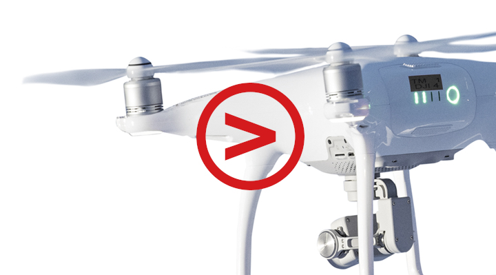
DJI PHANTOM 4 PRO CAMERA DRONE:
- Weight 1,388 grams
- Price about 1,600 euros
- Camera: 1” camera sensor and 24 mm f/2.8 equivalent lens, video resolution max. 4K 60P
- Flying time max. 30 min.
- Range up to 3.5 km
- Built-in GPS/GLONASS
- Five-direction obstacle sensing
- Remote controller has GPS, a compass, Micro-SD card slot and HDMI port
- Courses are available on safety and legal matters associated with flying a drone.