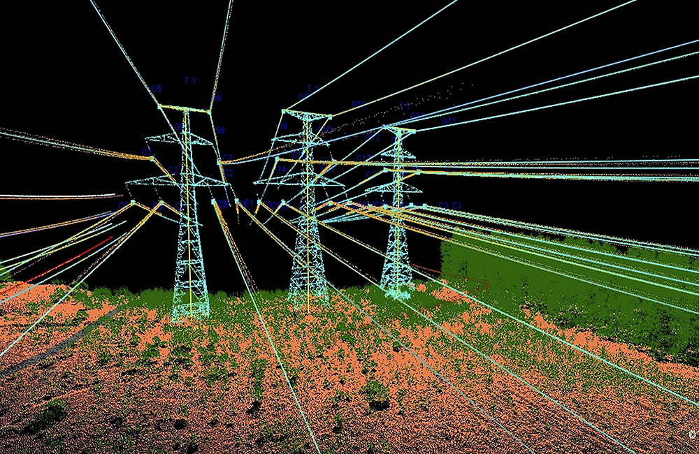
The network documentation is being updated with aerial photographs, which will enable an assessment of the network’s condition and the work that needs to be planned. When new lines are planned alongside old ones, the material enables a decision to be made at an early stage on the feasibility of designing new lines in the specific location.
In addition, the aerial photographs will be used to analyse the vegetation and assess whether action needs to be taken if trees in the border zones have grown too tall. When Fingrid’s asset information is up-to-date, it is able to make better decisions without necessitating field visits.
The aerial photography material will include accurate vertical images, known as orthophotos, laser scanning material, which can be used for a range of analyses, and detailed inspection images of structures.
The photographs will be taken from helicopters between May and September. We will release more detailed information about the timetable in the spring and summer. Check Fingrid’s website for more details.